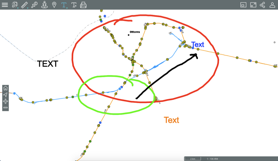
This tool allows you to draw annotations on the map. Your annotations can be saved in PDF format with the map.
To enable the annotation tools:
1.Click on  Annotations to display the drop-down menu.

 |
Annotations Allows you to draw annotations on the map. |
 |
Annotations Allows you to add text on the map. |
2.Select the tool you wish to use. You can switch from one tool to another by opening the drop-down menu.
Drawing on the map
To draw annotations on the map:
1.Click on to enable the tool. The icon turns blue  and specific tools will appear.
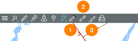
1 |
Colour palette for the line. |
2 |
Width of the line. |
3 |
Erase annotations. |
2.Specify the colour and the width of the line you wish to draw. At any time, you can change the line colour and width.
3.Click on a point and drag your finger or mouse pointer to draw your annotations.
4.Click on  to erase the annotations.
5.Click on to display the drop-down menu and use the other tool if you want to add text.
6.Click on to disable the tool. The menu closes and the icon turns grey .
Adding text
1.Click on to enable the tool. The icon turns blue  and is displayed in the toolbar along with the
  icon to clear the text.
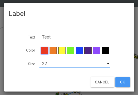
2.Click on the position where you wish to enter text. An interface displays, allowing you to enter the content and define the format.
3.Click on to delete the annotations.
4.Click on to disable the tool. The icon turns grey.
Annotations will remain on the map until the end of the session or until you erase them.