The Data
The data contained in the application is organized into layers. There are two types of layers in JMap Mobile: base maps, which form the map background, and layers, which contain various types of data and can be enabled or disabled as needed. Some layers can be edited in the application.
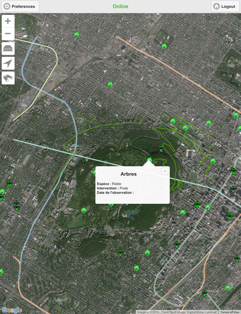
Layers can display descriptive data related to the spatial data, which can be accessed via mouseover bubbles.
To display data:
1.Touch the ![]() icon. The Layers menu displays. It contains the list of layers organized into three groups: Base maps, Layers, and Current editable layer.
icon. The Layers menu displays. It contains the list of layers organized into three groups: Base maps, Layers, and Current editable layer.
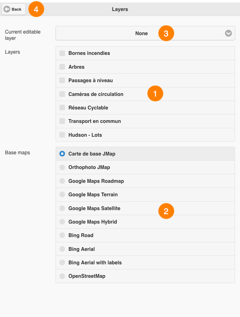
1 |
The list of layers found within the application. |
2 |
The list of base maps found within the application. |
3 |
This menu allows you to select a layer for editing. For more details on this function, refer to the Editing Data section. |
4 |
This button brings you back to the map interface. |
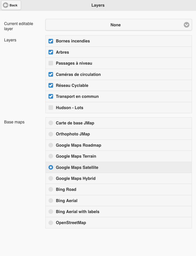
2.Select the layers you wish to display.
You can display several layers at the same time. The only restriction is the readability of the map.
3.Select the base map of your choice to display it.
You can only display one base map at a time.
Depending on your application's configuration, you may have access to maps created specifically for the application and/or maps taken directly from Web-based map servers such as Google Maps, Bing and OpenStreetMap.
4.Touch Back to return to the map interface. The data you selected will be displayed.
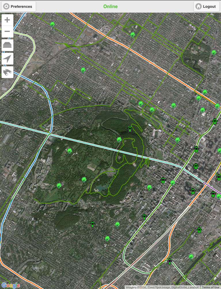
Some layers may be configured to be displayed within specific map scale intervals. They may not be visible at the map's current scale. You can change the scale (using your fingers or the ![]() and
and ![]() zoom tools) to display these elements. Your JMap administrator will give you the specifics of the layers.
zoom tools) to display these elements. Your JMap administrator will give you the specifics of the layers.
To display mouseover bubbles:
1.Touch an element on the screen. Its mouseover bubble displays.
2.Touch ![]() to close the mouseover bubble, or touch another element on the same layer or in another layer to display its mouseover bubble. The current mouseover bubble will close.
to close the mouseover bubble, or touch another element on the same layer or in another layer to display its mouseover bubble. The current mouseover bubble will close.