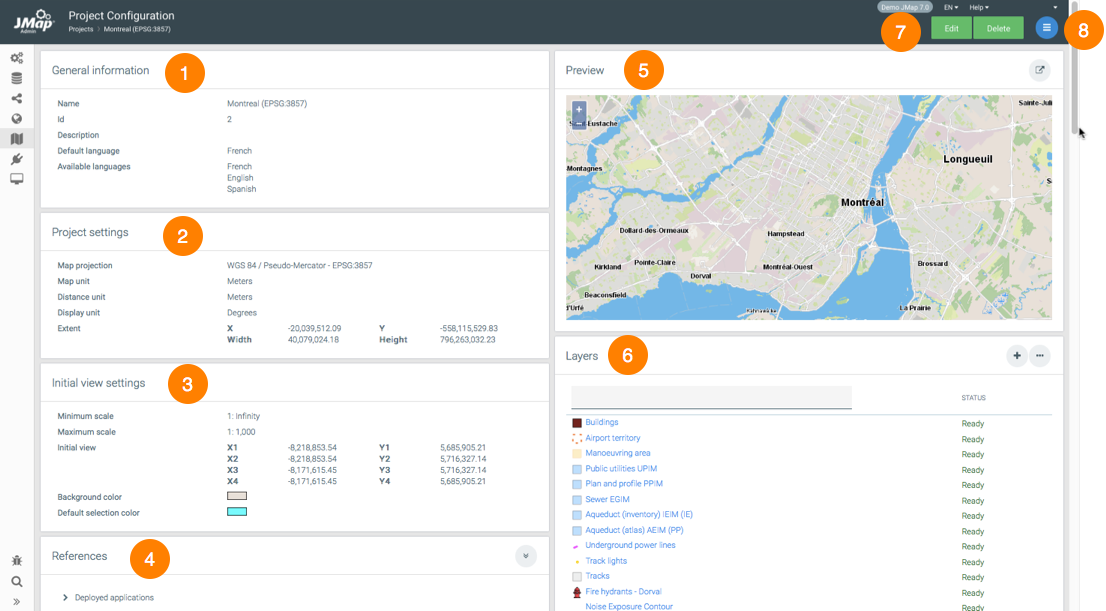
The configuration interface of a project allows you to access information on the project. This interface also contains functions to configure various parameters, such as the initial view of the project in the applications.

Project configuration interface
1 |
General information configured when creating the project. |
2 |
The project's parameters. They are configured when the project is created. The project's extent corresponds to the extent of the layers that make up the project. When the project does not have any layers, the values are equal to 0. |
3 |
Initial view settings. These parameters are specified when the project is created. The initial view is defined by clicking on |
4 |
References. This section indicates the deployed applications that use this project. |
5 |
Preview. This section displays when the project contains at least one layer. It shows a map preview, and you can zoom in or out on it. Click on |
6 |
Layers. This section shows a list of the project layers and their statuses. Shortcuts allow you to access the interfaces to add and organize layers. |
7 |
These buttons allow you to edit or delete the project configuration. |
8 |
The menu allows you to access the Layers, Queries, Permissions and Image producer sections. |
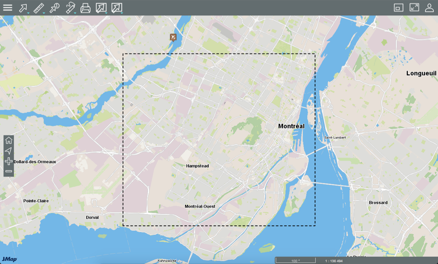
The JMap Web Preview opens a JMap Web application in a new browser window.

JMap Web Preview
The preview offers all the functionality of JMap Web applications and allows you to validate the project's configuration. It also allows you to configure the initial view of the project when it is opened in JMap Web applications. To do this, click on  and then on
  Initial extent. A rectangle displays to delimit the initial extent. Click on
  Maximum extent to display the maximum extent. When you close the preview, the geographic coordinates of the initial extent are automatically saved.
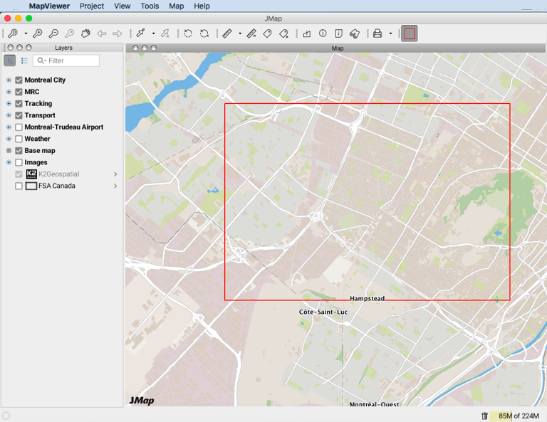
The JMap Pro Preview opens a JMap Pro application offering all the functionality of JMap Pro applications. You can validate the project configuration.

JMap Pro preview
You can also delimit the initial view of the project, when it is opened in JMap Pro applications. Click on  . A rectangle displays to delimit the initial view. When you close the preview, the geographic coordinates of the initial view are automatically saved.
The image producer of a JMap project is used to produce images on demand for that project. These images are used for JMap Web and JMap Mobile applications. When a user works in JMap Pro, the image producer is not used because the data is transferred in vector format (except for photos).
Normally, the image producer's settings do not need to be modified because the default configuration is adequate. The following table describes the settings of the image producer.
Memory settings |
|
Maximum size |
The maximum amount of memory allotted to the project's image producer. This memory is used to store the project's vector data in order to accelerate the production of images. For very large projects, this setting can be increased. |
Memory release |
Determines the percentage of memory to be released when the memory of the image producer is saturated. |
Thread pool settings |
|
Initial size |
The number of threads determines the number of images that can be produced simultaneously. |
Maximum size |
If the number of threads increases due to high demand, this value limits the number of threads. |
View wait timeout |
The maximum period before an image request expires. This option is usually disabled. |
Note: With previous versions of JMap (before 7.0), the image producer needed to be reset after changes were made in the project. This is no longer necessary with JMap 7.
 in the