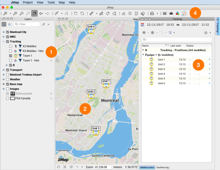
The mobile units managed with Tracking are represented by the map elements integrating the layers that the JMap administrator has created and made available to users in the application's layer manager.
Tracking's graphical interface is comprised of a dockable window, which provides information on the movement of mobile units. A set of buttons in the toolbar also allows you to perform specific functions.

1 |
Layers managed by Tracking, including the mobile units and their movement history. |
2 |
Mobile units and their movement displayed in the map interface. |
3 |
Tracking window displaying information on mobile objects and offering access to various functions. |
4 |
Tracking tools available in the toolbar. |
The Tracking window
This is Tracking's most complex graphical interface. It contains two tabs: Mobile units and Geofencing.
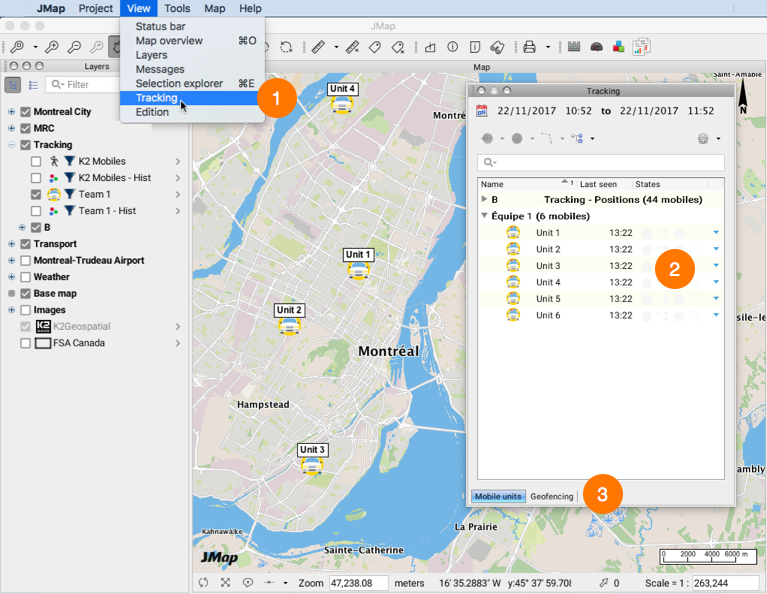
Like any other window in JMap Pro, the Tracking window can be toggled to floating mode or hidden.
The window displays when you position the mouse cursor on the tab of the ![]() extension.
extension.
It can also be enabled or disabled by clicking in the View - > Tracking section of the application's menu bar.

1 |
Enable or disable the Tracking window from the menu bar. |
2 |
The window can be displayed in floating mode, hidden from the screen or attached to the application's map interface. |
3 |
Both tabs offer specific information and functionality. |