The Graphical Interface
The graphical interface is streamlined and straightforward; all the space is dedicated to map-based data.
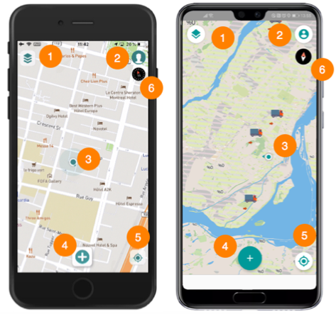
| 1 | Layers Touch to open the menu displaying the project’s data layers. |
| 2 | Account Touch to open this section, where you can configure offline mode or log out. |
| 3 | The location of your device is represented on the map. |
| 4 | Create an object Touch to display the list of objects you are authorized to create (depending on the project’s editable layers and their permissions). |
| 5 | Geolocation Touch to centre your location (geographic coordinates of your mobile device) in the map. |
| 6 | The compass indicates the map rotation. Touch the compass to cancel the rotation. |