The Graphical Interface
The graphical interface is streamlined and straightforward; all the space is devoted to map-based data.
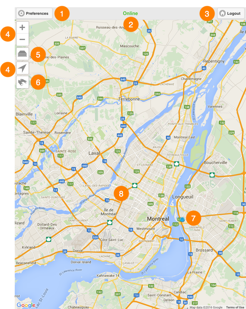
1 |
Preferences This button brings you to an interface where you can configure settings related to data and transactions management, application addresses, and the mode in which you want to work. For more details, refer to the Preferences section. |
2 |
Status A legend indicating the status of the connection to the JMap Server. Two statuses are possible: Online and Offline. |
3 |
Logout This button brings you back to the login interface. |
4 |
Navigation tools:
1.Touch to enlarge the center of the map (the zoom factor is set by default in your mobile device).
1.Touch to zoom out on the center of the map (the zoom factor is set by default in your mobile device).
1.Touch to center the map on your location (geographic coordinates of your mobile device). The button turns blue 2.Touch on the button again to disable the function. The button turns grey The geolocation function must be enabled in your mobile device. |
5 |
|
6 |
|
7 |
The map-based representation of the mobile device's location. |
8 |
The map interface. |