Once the spatial data sources and various project layers have been prepared, the Tracking layers must be configured in the Tracking extension's configuration. These are Tracking layers that will be displayed in Tracking's graphical interface in JMap applications.
1.Open the Tracking layers section in the Tracking extension configuration.
2.Click on Create to create a Tracking layer configuration.
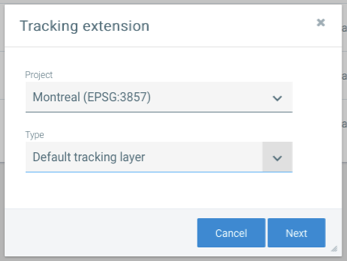
3.Select the project for which you wish to create a Tracking configuration as well as the type of configuration (normally Default tracking layer). Click on Next.

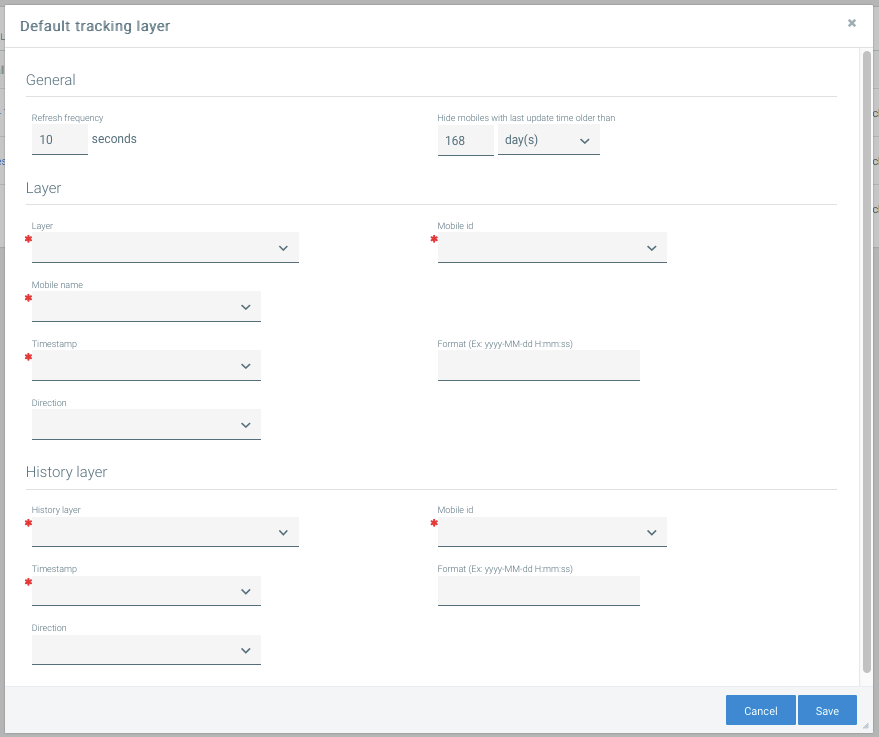
4.In this interface, you must enter several parameters to configure the Tracking layer.

The following table describes each parameter. When you are done, click on Save.
General |
|
Refresh frequency |
Determines the period of time (in seconds) after which the layer will be automatically refreshed in JMap applications. |
Hide mobiles with last update time older than |
Allows you to hide, in JMap's applications, the mobiles of this layer that have not had any activity since the time specified. This setting can be modified personally by each Tracking user. Enter 0 to disable this function for the layer. |
Layer |
|
Layer |
Select the mobile units layer that must be handled by Tracking for this configuration. This layer must have been created previously (refer to the Preparing Data Sources and Layers section). |
Mobile id |
Among the attributes bound to the layer, select the one containing the unique identifier for the layer's elements. |
Mobile name |
Among the attributes bound to the layer, select the one containing the name of the mobile unit. This name will be displayed to users in JMap's applications. |
Timestamp |
Among the attributes bound to the layer, select the one containing the date and time of the mobile unit's last trip. This must be a Date or Timestamp attribute. |
Format |
Indicate the data format used by the values of the attribute containing the date/time. This format may vary depending on the DBMS used. MySQL: yyyy-MM-dd H:mm:ss SQLServer: yyyyMMdd HH:mm:ss Oracle: dd-MMM-yyyy h:mm:ss.S a |
Direction |
Among the attributes bound to the layer, select the one containing the direction of the mobile unit. The direction can be represented on the map by a rotation of the symbol based on the value of this attribute. |
History layer |
|
History layer |
Select the history layer that must be handled by Tracking for this configuration. This layer must have been created previously (refer to the Preparing Data Sources and Layers section). |
Mobile id |
Among the attributes bound to the history layer, select the one containing the unique identifier for the layer elements. |
Timestamp |
Among the attributes bound to the history layer, select the one containing the date and time of the mobile unit's last trip. The attribute type must be Date or Timestamp. |
Format |
Indicate the data format used by the values of the attribute containing the date/time. This format can vary based on the DBMS used. MySQL: yyyy-MM-dd H:mm:ss SQLServer: yyyyMMdd HH:mm:ss Oracle: dd-MMM-yyyy h:mm:ss.S a |
Direction |
Among the attributes bound to the history layer, select the one containing the direction of the mobile unit. The direction can be represented on the map by a rotation of the symbol based on the value of this attribute. |