The Data
The data contained in the application is organized into themes and can be accessed through the map interface. The data of a single theme forms a layer to which descriptive data is associated. Layers are superimposed on one another to form the map displayed in the graphical interface.
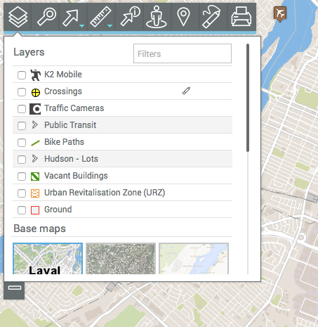
There are two types of layers in JMap Web:
1. Base maps, which form the map background;
2.Layers, which contain useful information; their display can be enabled or disabled, as needed.
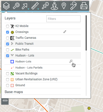
To display the layers, click on ![]() Layers. The drop-down menu appears. It contains the list of layers, organized into two groups: Layers and Base maps.
Layers. The drop-down menu appears. It contains the list of layers, organized into two groups: Layers and Base maps.
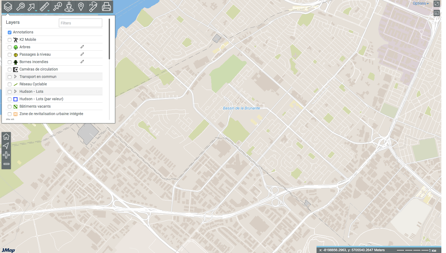
Layers
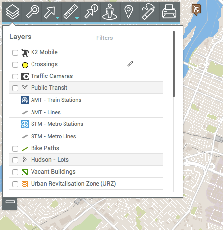
Layers contain spatial information pertaining to various subjects.
A layer can be made up of several different sets of data. To identify these composite layers, the rows where they are located are shown in grey. The data sets that make up each layer are displayed when you click on the arrow ![]() next to the name of the layer.
next to the name of the layer.
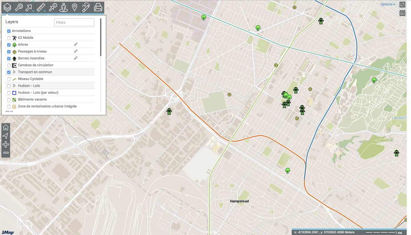
The Annotations layer displays when the user adds annotations to the map. The Drawing Annotations on the Map section provides details on this topic.
To view a layer:
1.Select the check box on the left of the layer name to display it in the map interface. You can display several layers at the same time. The only restriction is the readability of the map.
2.Unselect the check box to stop displaying the layer.
The pencil ![]() icon indicates that the layer can be edited. To enable layer editing:
icon indicates that the layer can be edited. To enable layer editing:
3.Click on the pencil![]() . The pencil will turn blue
. The pencil will turn blue ![]() to indicate that the editing functionality is enabled. The Editing Data section provides details on this topic.
to indicate that the editing functionality is enabled. The Editing Data section provides details on this topic.
4.Click on the pencil ![]() to disable layer editing. The pencil becomes grey again
to disable layer editing. The pencil becomes grey again![]() .
.
When the pointer is placed on the row of a layer, an arrow ![]() displays. This arrow can be used to make the layer selectable.
displays. This arrow can be used to make the layer selectable.
5.Click on the arrow![]() . The arrow turns blue
. The arrow turns blue ![]() , indicating that the layer's elements can be selected using the interactive selection tools. The Selecting Elements in the Map Interface section provides details on this topic.
, indicating that the layer's elements can be selected using the interactive selection tools. The Selecting Elements in the Map Interface section provides details on this topic.
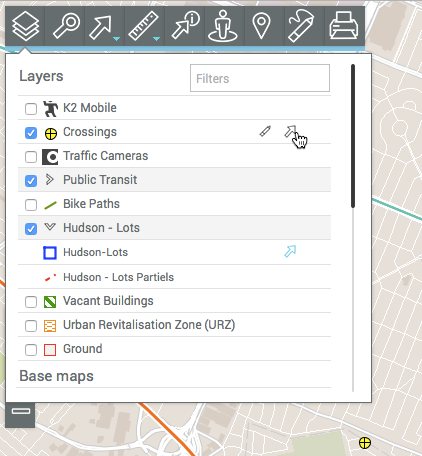
Only one layer can be selectable at a time.
For a composite layer, you can make each set of data selectable independently.
6.Click on the arrow ![]() if you do not want the map data to be selectable. The icon will become grey again
if you do not want the map data to be selectable. The icon will become grey again ![]() .
.
Base maps
Base maps form the background of the map interface and provide a context to situate the information contained in the layers. You can display one base map at a time.
Base maps can be configured specifically for the application or they can originate from Web map servers. When you position the mouse pointer on the icon of a base map, its name is displayed.
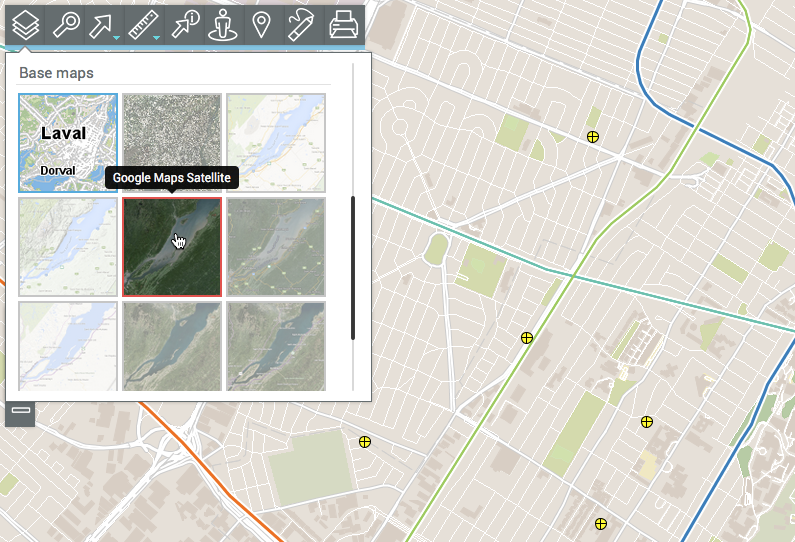
1.Click on the map of your choice to display it.
Depending on your application configuration, you can display maps taken directly from Web map servers such as Google Maps, Bing, and OpenStreetMap.