Search Tools
Table of contents
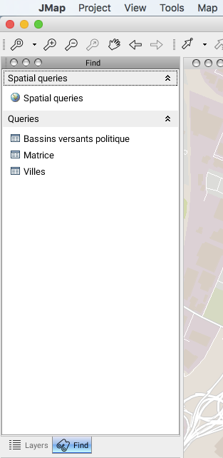
 Search tools allow you to find elements on the map using spatial (spatial query) or descriptive (attribute query) criteria. Attribute queries are defined in advance by the JMap administrator. The search window displays all available queries.
Attribute Queries
Attribute queries are used to find specific elements on a layer using the layer’s attribute values. By entering search parameters in the search form (defined by the system administrator), a query is performed in order to select the map elements meeting the criteria and display them in the elements explorer. Contact your system administrator for more information on available queries.
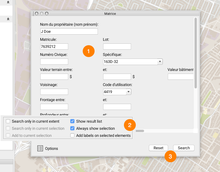
| 1 | Enter data in the form’s fields. In this example, select the name of the element you are searching for in the list. You can type just a few letters; the list will show the values that contain them. |
| 2 | Press the Options button to display a list of search options. The following options are available: Search only in current extent: The query will only be performed in the visible area on the screen. Search only in current selection: The query will only be performed in the elements that have been previously selected. Add to current selection: The results of the query will be added to the elements on the map that have already been selected. Show result list: Displays the results list in the elements explorer. Always show selection: Displays results, even when these do not fall within the visibility thresholds of the layers that are queried (this is useful when results span a very large territory). Add labels on selected elements: Displays a label on each element that is found (improves visibility of results). |
| 3 | Press Search to launch the query. Press Reset to reset the form. |
Results are selected on the map. If the Show result list option is selected, the elements explorer displays the elements returned by the query. It is then possible to launch an information report pertaining to the selection (refer to Information Tools).
Spatial Queries
Spatial queries are used to search for map elements of a layer that meet a spatial criterion. Several types of spatial criteria are available, but each uses a reference selection as a basis for the search. Therefore, before performing the spatial query, it is essential that you select the reference elements.
Some examples of spatial queries:
- Select properties located at less than 500 meters from the selected park.
- Select route segments located within the selected zoning polygon.
- Select all lots adjacent to the selected river.
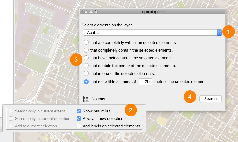
| 1 | Select the information layer on which the search is performed (what you are looking for). The spatial query can only be performed on a selection that has been made beforehand. |
| 2 | Press the Options button to display a list of search options. The following options are available: Search only in current extent: The search is performed only on the area that appears on the screen. Search only in current selection: The search is performed only among the elements that are already selected. Add to current selection: The results of the query will be added to the elements on the map that have already been selected. Show result list: Displays the results list in the elements explorer. Always show selection: Displays results, even when these do not fall within the visibility thresholds of the layers that are queried (this is useful when results span a very large territory). Add labels on selected elements: Displays a label on each element that is found (improves visibility of results). |
| 3 | Choose the spatial criteria to apply for the query. |
| 4 | Press Search to launch the query. |
Results are selected on the map. If the Show result list option is selected, the elements explorer displays the elements returned by the query. It is then possible to launch an information report pertaining to the selection (refer to Information Tools).